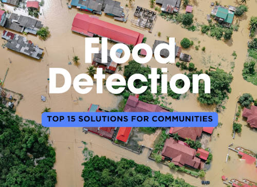
Floods can strike without warning, but thanks to technological advancements, communities are now better equipped to detect and respond to potential floods before they cause widespread damage. Early flood detection systems have evolved significantly in recent years, utilizing cutting-edge technologies to monitor water levels, weather patterns, and environmental conditions. These systems allow for faster responses, giving individuals and communities valuable time to prepare and minimize damage. Below are five of the latest innovations in flood warning systems, each playing a crucial role in improving disaster preparedness.
1️⃣ 📡 IoT-Enabled Sensors
Description: Internet of Things (IoT)-enabled sensors are placed in rivers, streams, and flood-prone areas to continuously monitor water levels, flow rates, and rainfall. These sensors transmit real-time data to centralized systems, alerting authorities and the public when flood conditions are detected.
Additional Benefits:
- Provides real-time data on water levels
- Can be deployed in remote areas
- Lowers maintenance costs with long-lasting batteries
2️⃣ 🌧️ Satellite-Based Monitoring Systems
Description: Satellite-based systems monitor weather patterns and rainfall accumulation across vast areas, providing early flood warnings based on large-scale environmental data. These systems can track storm developments and predict potential flooding by analyzing changes in cloud formations and precipitation.
Additional Benefits:
- Offers wide-area coverage
- Useful for remote or inaccessible regions
- Integrates with global weather monitoring for enhanced predictions
3️⃣ 📲 Flood Warning Mobile Apps
Description: Mobile apps designed for flood detection provide real-time alerts to users based on their location. These apps often integrate data from government agencies, weather services, and IoT sensors to give personalized flood risk warnings. Users can also receive evacuation routes and emergency contacts during critical situations.
Additional Benefits:
- Provides instant alerts to users
- Offers location-specific flood warnings
- Includes emergency response information
4️⃣ 🌐 AI-Powered Flood Forecasting Models
Description: Artificial Intelligence (AI) has transformed flood forecasting by analyzing vast datasets of historical weather patterns, river flow data, and current environmental conditions. AI models can predict floods with greater accuracy by identifying patterns that human analysts might miss, allowing for more timely warnings.
Additional Benefits:
- Improves accuracy in flood predictions
- Analyzes large datasets quickly
- Learns and improves over time for better forecasting
5️⃣ 🌡️ Weather Drones
Description: Drones equipped with weather sensors can fly over flood-prone areas to monitor conditions in real time. These drones capture data on rainfall, humidity, wind speed, and more, providing a detailed, on-the-ground perspective of potential flood risks. They are especially useful for assessing areas that are difficult to access.
Additional Benefits:
- Provides real-time aerial data
- Useful for hard-to-reach areas
- Reduces the need for ground personnel during monitoring
1️⃣1️⃣ 📊 Hydrological Modeling Systems
Description: Hydrological modeling systems simulate how water moves through different landscapes and environments. These models use data on rainfall, soil moisture, and land elevation to predict flood risks in specific areas, helping authorities plan for potential flooding.
Additional Benefits:
- Helps predict river and stream flows
- Useful for long-term flood management
- Enhances understanding of local water cycles
1️⃣2️⃣ 🌍 Smart City Flood Detection Systems
Description: Smart city infrastructure integrates flood detection with other urban systems. Sensors placed in drainage systems, streets, and waterways communicate with a central platform, allowing city authorities to monitor flood risks in real-time. This system automatically adjusts traffic lights and alerts citizens via mobile apps when flood risks arise.
Additional Benefits:
- Enhances urban resilience
- Enables automated responses to flooding events
- Integrates with city-wide emergency systems
1️⃣3️⃣ 🌐 Crowdsourced Flood Mapping
Description: Crowdsourced flood mapping involves local residents reporting flood events in real time via mobile apps or social media. These reports are collected into a central platform, allowing authorities to monitor flood progression as it happens and respond more effectively.
Additional Benefits:
- Increases community engagement in flood monitoring
- Provides real-time, localized data
- Useful for monitoring areas without formal systems
1️⃣4️⃣ 🌡️ Ground Penetrating Radar (GPR)
Description: GPR uses radar pulses to image the subsurface, helping detect areas of soil saturation that could lead to flooding. It’s particularly useful for detecting underground water channels and assessing soil stability in flood-prone areas, giving early warning before visible signs of flooding appear.
Additional Benefits:
- Detects hidden water movement beneath the surface
- Useful for pre-emptive flood risk assessment
- Assists in infrastructure planning in flood zones
1️⃣5️⃣ 🏘️ Community-Based Flood Monitoring Networks
Description: These networks involve local volunteers and residents working together to monitor flood risks in their neighborhoods. Using simple tools such as water gauges and weather data, they provide vital information to local authorities, allowing for faster, more localized responses to flooding events.
Additional Benefits:
- Promotes community involvement in disaster preparedness
- Increases coverage in areas lacking official monitoring systems
- Strengthens local knowledge of flood risks


