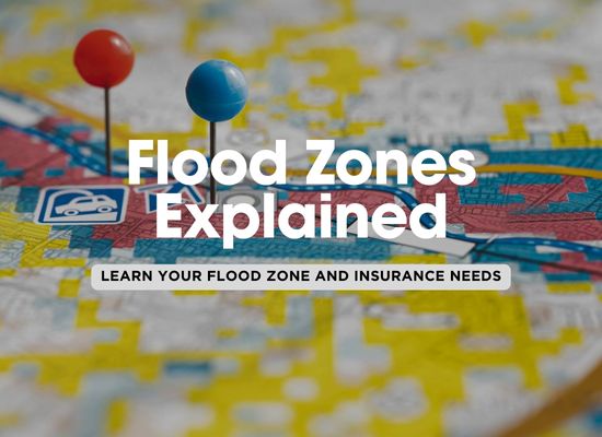
Flood maps are an essential tool used by governments and organizations to determine areas that are at risk of flooding. These maps are often used to assess flood insurance needs, guide city planning, and inform residents of potential hazards. With climate change contributing to more severe weather patterns, understanding flood maps is increasingly important to safeguard both property and lives.
 What Are Flood Maps?
Flood maps, also known as Flood Insurance Rate Maps (FIRMs), are created by experts who analyze historical flooding data, weather patterns, and topography to identify areas that are susceptible to flooding. They are typically used by government agencies, insurance companies, and property owners to assess flood risks.
Why It’s Important:
- Flood Risk Assessment: These maps help identify which areas are at risk of flooding and guide decisions related to building permits, zoning, and insurance.
- Insurance and Regulations: Flood maps determine flood insurance requirements and can influence the premiums you pay for flood coverage.
What to Look For:
- Flood Zones: Flood maps highlight different flood zones, typically categorized from low risk to high risk (like Special Flood Hazard Areas or SFHAs).
- Base Flood Elevation (BFE): This is the expected height of floodwaters during a 100-year flood and is used to determine floodplain boundaries.
 How to Read a Flood Map
Reading a flood map can seem overwhelming, but once you understand the key symbols and zones, it becomes much easier. Flood maps use different colors and labels to indicate varying levels of flood risk, ranging from minimal to high. Typically, areas most at risk are shown in dark red or blue, while low-risk zones appear in lighter colors.
Why It’s Important:
- Understanding Your Risk: Knowing how to read a flood map can help you determine your vulnerability to flooding and prepare accordingly.
- Planning and Decision Making: Homebuyers, renters, and businesses can use flood maps to make informed decisions about where to live or invest.
What to Look For:
- Flood Zones (A, B, C, X): Flood zones are often labeled with letters, with “A” being high risk (100-year floodplain) and “X” being low risk (area outside the 500-year floodplain).
- Floodways and Coastal Areas: Look for areas that are near rivers, coastlines, or other bodies of water, which may have specific regulations or higher flood risks.
 Understanding Risk Levels
Flood maps categorize risk levels into several zones, such as High Risk, Moderate Risk, and Low Risk. High-risk areas are typically flood zones A and V, where properties are most likely to experience flooding due to heavy rainfall, snowmelt, or storm surges. Moderate and low-risk areas are less likely to experience flooding, but they still carry some risk, especially in the event of extreme weather conditions.
Why It’s Important:
- Insurance Decisions: Your flood zone will determine whether flood insurance is mandatory and how much it will cost.
- Property Values: Knowing the risk level can influence property values, as homes in high-risk areas may be harder to sell or more expensive to insure.
What to Look For:
- Flood Zone Designation: Zones like A (high risk), X (low risk), or V (coastal high risk) are critical to determining your potential flood exposure.
- Special Considerations for Coastal Areas: Coastal areas (Zone V) are at risk of storm surge, which is distinct from river flooding and can cause significant damage.
 Flood Map Updates and Changes
Flood maps are not static and are regularly updated to reflect changes in flood risks. These updates are typically driven by new data, such as changes in local topography, improvements in flood prediction models, or the effects of climate change. It’s important to stay informed about any revisions to flood maps in your area, as they could affect your insurance requirements or property value.
Why It’s Important:
- Changing Risk Levels: As communities grow, rivers change course, or climate patterns shift, flood risks may increase or decrease. Regular updates ensure that flood information remains accurate.
- Insurance Reassessment: If your property’s flood zone changes from a low-risk to a high-risk area, you may need to adjust your flood insurance policy.
What to Look For:
- Local Flood Map Updates: Check with your local municipality or FEMA for updates to flood maps, especially if new developments or natural disasters occur.
- Revised Risk Levels: Pay attention to changes in your zone classification, as it may affect insurance rates or even building codes for future construction.
 How to Protect Your Property from Flood Risks
Even if you live in a low-risk area, flooding can still occur due to extreme weather events. If you live in a high-risk zone, taking proactive steps to protect your property can help minimize damage in the event of a flood. Consider investing in flood-proofing measures, including elevating your home, using flood barriers, and waterproofing key areas.
Why It’s Important:
- Flood Prevention: Protecting your property from flooding can help reduce the financial and emotional costs of dealing with water damage.
- Long-Term Savings: Flood-proofing your home can reduce insurance premiums and prevent costly repairs.
What to Look For:
- Elevating Your Home: In high-risk areas, homes may be elevated above the base flood elevation (BFE) to prevent flood damage.
- Flood Barriers and Barriers for Windows: Waterproof barriers and flood shields for windows and doors can keep water out during heavy rains.
- Landscaping and Drainage: Proper landscaping and improved drainage can help redirect water away from your property.
Understanding flood maps is crucial for assessing your flood risk and taking the necessary steps to protect your property. Whether you’re located in a high-risk area or a low-risk zone, staying informed about flood zones, risk levels, and flood map updates is the first step to ensuring you’re prepared for the unexpected. Proactive measures like flood-proofing your home and purchasing flood insurance can provide peace of mind, no matter what the future holds.


